Saturday, June 27, 2009


Thank you note to Bob Dylan
Dear Bob, thanks for your note on the successful completion of the eastern portion of our trip. I have been a huge fan of yours for many years and it was a thrill to learn that you have been following our daily progress. I guess even you need to periodically take a break from the creative song writing stuff and read something mindless like our blog.
It just doesn't seem possible that It's All Over Now Baby Blue.
Most of the Time we really enjoyed ourselves, except when we rode through Buckets of Rain during the last few days or were Blowin' In the Wind in Kansas.
Sure, there were some tough days and areas of the country we saw that looked like Desolation Row. We just tried to preserve our Dignity even when we were Stuck Inside of Mobile With the Memphis Blues Again. And of course we took a few wrong turns, resulting in Highway 61 (being) Revisited, even when we thought we were Positively (on) 4th Street.
Just Like a Woman, Penny complained at times about the smell. In those moments I would either tell her It Ain't Me Babe or that You're a Big Girl Now.
All I Really Want To Do at this point is get On the Road Again to start the western part of our trip. I look forward to arriving back in Colorado after that's over, when I Shall Be Released to go do something else.
Thanks again Bob.
Sent from my Verizon Wireless BlackBerry
Monday, June 22, 2009
Raynham to Mashpee, MA
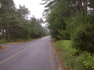
(Ridden June 21st). 51 miles. We completed the eastern leg of our trip today, a rainy and windy ride through heavy traffic onto the Bourne Bridge and beyond on Cape Cod. It was like two different rides. The first 20 miles or so were on quiet secondary roads and we were able to ride down the middle of the right lane for much of the morning. And while we were damp, initially we rode in a morning mist rather than true rain. However, once we approached the bridge (one of two linking the Cape to the mainland), the rain began to fall in earnest and the traffic volume ramped up dramatically. As we approached the bridge on Route 28, the shoulder suddenly disappeared. We had some anxious moments riding on a busy 4 lane highway with no shoulder in a steady rain and limited visibility. Then, for the second day in a row, we found ourselves in a frightening situation. We had ridden up the on ramp to the Bourne Bridge, which has no shoulder or bike lane, to find the east bound lanes packed with bumper-to-bumper traffic moving past us at very high speed. We had wrongly assumed that there would be little traffic going to the Cape on a rainy Sunday afternoon. The reality was quite a shock. So we decided we should cross the bridge on the sidewalk, only to discover that there was a high chain link fence between the roadway and the sidewalk at the point where the on ramp joins the bridge. We were trapped on the bridge in the traffic lanes and had no choice but to pedal (uphill) into the traffic lanes to a point further east where the fence disappeared and we could pull the bike and trailer onto the sidewalk. It was only a very short distance - perhaps 20 or 30 yards - but it seemed like an eternity as cars, trucks and buses flew past us in the mist and rain. After calming our nerves a bit, we walked the bike across the bridge and found a place to get something to eat, thankful that we had avoided another dangerous situation.
We again met some terrific people along the way. The owner of a local convenience store near South Middleboro welcomed us out of the rain with hot coffee and baked goods. We spent a good 45 minutes there chatting with her and another customer, who were very interested in our trip. After the harrowing Bourne Bridge experience we stopped in the Lobster Pot, a shoe box-sized roadside restaurant that sold live lobsters to go as well as sandwiches, chowder, etc. The owner apologized for the cramped conditions in the place (there were at least 10 people inside) and offered to help dry us off (we declined, as it seemed pointless). We met another couple there who had done some tandem touring and had previously lived in Colorado. They spent a long time chatting with us, then went outside into the rain to check out our rig. They had a lot of questions, but after several minutes outside again we began to get chilled, so we politely disengaged ourselves and set off again down Route 28.
It feels great to have completed this portion of the ride - 2,600 miles over just under 2 months and covering 9 states. At the same time we are a little wistful knowing that this part of what is likely a once-in-a-lifetime experience is over. We genuinely appreciate all of the supportive comments and interest you blog readers have provided. They really helped keep us going on days when things weren't going so well.
Stay tuned here for the western section narrative, to begin around the third week in July.
Sunday, June 21, 2009


The Bourne Bridge onto the Cape

Sent from my Verizon Wireless BlackBerry
C-store owner and customer

Sent from my Verizon Wireless BlackBerry


Saturday, June 20, 2009
Whitinsville to Raynham, MA
45 miles. With the exception of the very end of today's ride, it was a very good day. After we topped a couple of knee-busting hills leaving Whitinsville, the terrain leveled out a lot and we were therefore able to make much faster progress. And despite the heavily populated nature of the area, at least 1/2 of today's ride was on relatively quiet secondary roads that were densely wooded and sprinkled with ponds and creeks. The weather was pretty darn good too - partly cloudy and neither cool nor warm.
The very last stretch today involved about 4 miles on very busy US 44, which wasn't really too bad until just before we neared our hotel. The motel (Hampton Inn) sits at the junction of US 44 and state highway 24 (44 runs east-west and 24 runs north-south). The hotel sits on the northwest corner of this intersection. We were riding east on 44, so we would assumed that we could make a left turn into the hotel lot. But we discovered that 44 is divided highway at that point; there is a median preventing east bound traffic from turning left. So we decided to get off 44 (turning south onto 24), thinking we could cross 24 (go north) then take the westbound on ramp for 44. BIG mistake. 24 turned out to be even more divided than 44, the equivalent of a freeway with a guard rail dividing the north and southbound lanes. Nor did 24 have any kind of shoulder at all. So we were in a quandary - do we try to ride south on 24, which would take us away from our destination and require us to ride in the right lane of a very busy, high speed highway? Should we go backwards up the ramp from 44 that we had just come down (assuming we could find enough room at the bottom of the ramp to turn the tandem and trailer around)? Or do we walk the bike northward on 24, against traffic, until we could reach the westbound on ramp for 44? The latter choice seemed to be the best, and we managed to do it safely. But it was a hair-raising experience. Dealing with the southbound traffic whizzing by was unsettling as we walked up the lane against traffic. Worse however was trying to avoid cars leaving the on ramp to 24 that had exited 44 westbound. There were a lot of trees and bushes obscuring our view of the on ramp. So Penny went to the edge of the ramp where she could get a better view of oncoming traffic, gave me the "go" sign and I sprinted across the ramp pushing the tandem and trailer onto a weed-filled median in between the westbound exit ramp and the westbound entrance ramp for 44. Penny then joined me, we pushed across the median and hopped on the bike in the westbound on ramp to 44. Within minutes we were safely in the hotel's lot. I wish that I could say that I learned a lesson from this experience, but I don't know what we could have done differently. There was no way to tell from Google Maps or the GPS that the two highways were divided in this manner. Perhaps we should have studied the situation more carefully before we went down the southbound 24 ramp.
On a lighter note, we are enjoying listening to the local accents. We stopped for lunch at a Subway today and Penny ordered a yogurt. The female clerk said "what flavah of yoga you want?" While ordering at dinner tonight, our server recommended the "lobsta" and, when Penny sneezed a moment later, she said "dat is the cutest sneeze evah!"
Tomorrow we plan to complete the eastern portion of our trip, finishing at my sister's house in the town of Mashpee on Cape Cod. We are both excited and a little wistful as we think about the experiences we've had (mostly good) and the people we've met (all good).
B&B hosts in Whitinsville

Sent from my Verizon Wireless BlackBerry

Friday, June 19, 2009
West Brookfield to Whitinsville, MA
32 miles (approx). We were rained on (off and on) today again, but unlike yesterday the weather was warm, so being wet wasn't that big a deal and we had a pretty good day. The route was mostly over relatively quiet secondary roads. Again we crawled up lots of steep hills, but they were much shorter climbs than what we've been experiencing for the last couple of days.
We were thankful though that we split yesterday's and today's ride into two rather than one day. Even if we'd had perfect weather yesterday, 60+ miles of this kind of terrain would have pushed our endurance limits.
We were thankful though that we split yesterday's and today's ride into two rather than one day. Even if we'd had perfect weather yesterday, 60+ miles of this kind of terrain would have pushed our endurance limits.
We are in Whitinsville tonight, a former company town that was built around a large factory. Mr. Whitin owned the company that owned the factory (I'm not sure what it produced), so he naturally named the place after himself.
The company built housing for everyone, with the workers housed right next to the factory in row houses (now apartments), then middle management in modest single family houses a bit further away (up a hill), executives in elegant homes similar to those we have seen in many small towns on this trip and finally the Whitin family in palatial estates at the top of the hill. I guess you always knew your place back in those days.
We walked around town and stopped at a local hardware store (i.e., not part of a chain). I explained our problem with the missing special machine screw for the computer transmitter, and within minutes an employee had pulled a screw out of a drawer that matched what we needed in length and thread size/pattern. It cost me $1.17 and fit perfectly, but only because I purchased two different length just to be safe. I would have gladly paid at least $40 for the darn thing, since we really need a functioning computer to help us navigate the last couple of days to Cape Cod (lots of turns, unmarked roads, roads that change name every few miles, etc. - you need all a help you can get under these circumstances to avoid getting lost). Also, even if there were some place to buy a new computer here, which there isn't, a new one would cost about $40 anyway. The guy was thrilled that he was able to help us complete our journey.


Thursday, June 18, 2009
Hadley to West Brookfield, PA
30 miles (approx.) Today was ugly in a big way. For starters, a cold rain fell on us almost continually. Yes, I agree that we were sooooooo due for a rainy day, but that doesn't mean we have to like it. Then, within a few miles of starting the ride, we had a flat tire. It was the rear again, naturally, which is a major pain to repair. We were on a bike path at the time, one that bypasses Amherst and busy Route 9. That was a good thing, as it allowed us the luxury of being able to change the tire away from the traffic, road kill, etc. And the rain had pretty much stopped, another good thing. But the bike path ran through the middle of a swampy area. As soon as we stopped to begin the repair process (unloading the tandem) swarms of mosquitoes descended on us. I am one of those people that must smell good to mosquitoes - they just love me. (If there are 10 people standing together and a mosquito comes along, I will be bitten first every time.) So I had an awful time trying to replace the tube while swatting (mainly ineffectively) at the blood thirsty bastards. They took at least a quart with them.
Soon after getting underway again the rain resumed and never really stopped again. Ironically, it probably would have been better if it had continued raining while we were repairing the tire, as it likely would have helped hold back the mosquito infestation.
The bike path ended and dumped us out on some very hilly secondary roads that eventually led us back to Route 9. It carries a lot of traffic as it winds west-east (as well as up and down)across Massachusetts. Much of Route 9 has a good paved shoulder, but we discovered there are several long stretches with little or no shoulder. Riding those sections in good weather would be nerve racking; on an overcast day during a downpour was pretty much a white knuckle experience.
We pulled into a grocery store to take a break, eat something and get a new battery for the transmitter of our cyclometer. The good news is that they carried the correct battery, but in replacing it we discovered that we had lost the special threaded screw that holds the transmitter on the front fork (which allows it to send a signal to the handlebar unit as the magnet attached to the wheel passes the transmitter during each revolution of the wheel.) So the bottom line is that we do not have a functioning computer to tell us distance, speed, etc. This increases the chances that we will get lost, miss turns, etc., as our directions are written, for example, as follows: "In 1.7 miles {from the last turn}, turn right onto Podunk Road". At least that did not occur today. Finally, we discovered that although we are through the Berkshires, the terrain is still quite hilly. There were a lot of fairly steep climbs today, some quite lengthy.
We stopped in Ware to find something hot to drink. We could not find a C-store or a cafe, only a Subway and a Friendly's ice cream store - neither of which served coffee, soup or any other warm beverage. We finally found a pizza place that had coffee where we also wolfed down a plate of hot spaghetti. But we were still soaking wet, tired and discouraged. We had intended to ride about 60 miles today to Whitinsville, but it was clearly time to consider "Plan B". So we began searching for a motel, B&B or other lodging out of the rain. All of the places we located in Ware were either closed or did not answer the phone (not a good sign). We were able to find a nice "mom and pop" motel in West Brookfield, which involved another 5 miles of white knuckle riding further east on Route 9. While the rest of our day was forgettable, our innkeeper has been great. She was very interested in our ride, offered to launder all of our wet soggy clothes, gave us some extra motel towels to use to wipe down the bike* (which, of course, is in the room with us) and loaned us a golf umbrella to use to walk into town. She is a granddaughter of the man who built the motel, which is obviously still in the family.**
*This was astonishing as virtually all the other motels we have stayed in had signs up stating "DO NOT USE TOWELS FOR CLEANING CARS, WEAPONS, ETC." or something similar. And, true to form, one of her towels was soon black with chain grease, road grime, etc. However, it still might be useful in cleaning up the aftermath of a runaway orange juice dispenser.
**Penny got the innkeeper's life story during a long chat in the comfort of the warm motel office while I stood outside in the downpour holding the tandem/trailer, which has no kick stand, and shivering from near hypothermia. Contrary to what you might think, and despite the fact that I am admittedly an impatient person, I wasn't the least bit upset about this and only mention it in the interest of blog completeness.
Trailside flat tire repair

Sent from my Verizon Wireless BlackBerry
Wednesday, June 17, 2009
Pittsfield to Hadley, MA
49 miles (approx.*) We knew when we planned this ride that today would be one of the toughest, and we were right. The route today crossed the Berkshires, an Appalachian chain of low mountains that is crisscrossed by roads that were generally established before the Revolutionary War.** We had 4 major climbs today, each 3-4 miles in length and insanely steep. We were nevertheless able to ride two of these entirely but had to push the tandem up part or all of the other two. The first of these was the worst of all - even walking the bike up the steep grade was laborious forcing us to stop every 1/4 mile or so for a breather. Naturally downhills were just as steep, requiring us to brake so much that the tandem's rims became hot to the touch. After spending over 90 minutes to complete the first climb and descent in this fashion, we were dismayed to realize that we had traveled less than 9 miles. But we kept at it and the grade of the other climbs was generally more forgiving, allowing us to ride most of the rest of the way.
When we weren't hyperventilating from the exertion, we were admiring the stunning scenery, every view of which was filled with hardwood trees, lakes, creeks, green fields and green hills. We had very little traffic to be concerned about and, oh yes, the weather was again sunny and cool - perfect for struggling up mountain roads.
We stopped for lunch at Liston's, a bar in Worthington (elevation 1,810 feet), which proved to be an excellent decision as we saw no other open eating place until we had nearly finished riding. We ate tuna fish and turkey wraps made from scratch while we chatted with the owners (the Listons). They were really fired up about our trip and gave us last of the tee shirts they had created to promote their bar ("Highest Bar in Massachusetts").
After a very long descent out of the Berkshires, we arrived in Northhampton, where - with some help from a local cyclist - we found our way onto the Norwottuck bike trail, which parallels very busy Route 9 from Northhampton to east of Amherst. Unfortunately, there is currently an uncompleted gap in the trail that - without any signs to aid us - required us to navigate through the parking lot of a shopping center, cross a busy street, go behind a Walgreens under construction and then carry the tandem and trailer (after decoupling the latter from the former) over a weed bank and a series of active railroad tracks. It was urban cycling at its finest.
*The battery in the transmitter of our cyclometer died mid-ride, so we aren't sure how long the ride today was.
**In the late 1800s the moneyed industrialists built "cottages" in the Berkshires (and the nearby Hamptons),both in Western Massachusetts, for their families to spend part of the summers here away from the heat and humidity of the east coast cities. Pittsfield, for example, is the locale of 4 of these "cottages", which are 10,000 square feet or more in size and were originally were set on hundreds of acres.

Typical Berkshire climb pic #2

Sent from my Verizon Wireless BlackBerry
"Heart attack" profile of today's ride

Sent from my Verizon Wireless BlackBerry
Tuesday, June 16, 2009
Schenectady, NY to Pittsfield, MA
51 miles. A challenging ride, but a good day nevertheless as we crossed our last state line (Massachusetts). For the first half of the day, we navigated through the Schenectady-Albany metro area. We arrived at the west bank of the Hudson River in downtown Albany without any major problems, but had trouble finding a way onto the bridge across the river (which serves an I-787 as well as the state highway {Route 20} that we were following). Since guys like me are pretty much incapable of bringing themselves to ask for directions, Penny asked a policeman for help. He told us there was a pedestrian bridge that cyclists were to use, which was welcome news to us as we did not relish the idea of riding on a bridge serving busy interstate and state highways. But after riding back and forth along the waterfront bike path for awhile, we couldn't find the pedestrian bridge. So (gulp) I asked a couple walking along the path if they knew where the pedestrian bridge was. They turned out to be tourists from Cape Cod, but he had just moments before noticed the pedestrian LANE attached to the I-787/Route 20 bridge, which was literally over our heads at that point. They appeared to be amazed that we had successfully ridden over 2,300 miles through 8 states yet we couldn't see a gargantuan mesh metal-enclosed bike lane that we could nearly reach up and touch.
We managed to find our way onto the lane (basically, a sidewalk separated from traffic) and successfully (and safely) crossed the river.
Once we cleared the suburbs on the east side of the river, the road began to climb and fall significantly as we approached the border and the Berkshire Mountains. There were a couple of fairly steep climbs of 2-3 miles in length and we were frequently using our lowest gears. There were some steep descents as well; even with the drum brake on the tandem + trailer hit nearly 40 mph on a couple of these. The compensation for having to do these long grinds was the superb scenery along the way, as you can hopefully see in the pictures I took today. The hills and fields were bright green from all of the rain this year and the creeks were running clear and full. And the weather was again near perfect - cool and partly cloudy.
The elevation graph of tomorrow's route looks like the EKG readout of a heart attack patient, so it will likely be an even more challenging day. But it's hard to complain about riding through such a beautiful area.

Operators are standing by...

Sent from my Verizon Wireless BlackBerry


Monday, June 15, 2009
Rest day in Schenectady, NY
We took a planned day off today to do some touristy sight-seeing. We only have 5 planned riding days left before we arrive at our destination in Mashpee on Cape Cod. So, unless something unexpected happens, this is our last planned day off on this leg of our trip.
We rented a car and drove to nearby Albany to pick up a new bladder for my Camelbak hydration pack. The old one had developed a leak, resulting in cold Gatorade oozing into my shorts as we rode every day for the last several days. It's an experience I don't recommend. Then we drove to Cooperstown to tour the Baseball Hall of Fame. It was worthwhile, as we both have some interest in the sport (mine dropped dramatically after the players' strike of about 10 years ago). The drive down there, which took about 90 minutes, was just beautiful. It was primarily on Route 20, which was our originally planned route across New York. We were glad we were not riding it once we saw how hilly it was. We also drove through a hellacious thunderstorm on the return trip, which dropped several inches of hail on the highway. If we had been riding through that kind of storm, we probably would have thrown the bike in a ditch and gone looked for a hole to dive into.
There were a lot of kids also visiting the BHOF dressed in their Little League uniforms, with their coaches/adult chaperons similarly dressed. My favorite part was an exhibit of pictures of baseball in Cuba, including several pictures of kids playing the game in the street using a bottle cap in place of a ball.
Hailstorm on highway

Sent from my Verizon Wireless BlackBerry


Sunday, June 14, 2009
East Herkimer to Schenectady, NY
65 miles. Without doubt, this was the best ride we've had in some time. The weather was again near-perfect (we've just decided we are living charmed lives in that regard) and the route took us in a generally downward path along the Mohawk River valley. There was little traffic (today is Sunday) and the road surface was in great shape, so we were really able to enjoy the beautiful scenery.
We stopped for breakfast twice. The first time was at Pam's Place, which is just down the road (Route 5)from the disgusting motel we stayed in last night in East Herkimer (the place smelled bad and the carpeting looked as though it had not been cleaned or replaced since the 1950s). Our waitress and several of the other customers were very interested in our trip (she was appalled that we had spent the night at the aforementioned motel) and wished us a safe and pleasant trip, as many other people have up until now. But, we reminded ourselves, this is New York where a Wal-Mart employee was trampled to death by early morning shoppers trying to beat everyone else to the bargains. Anyway, the second breakfast was in Amsterdam. We rode around the town (a fairly tough-looking place) for at least 30 minutes looking for a place to eat lunch, including riding the wrong way on a one-way street for quite a while because we could not find a better alternative. We finally found an upscale cafe open although we were the only customers and they were only serving breakfast (despite the fact that it was 1:30 in the afternoon by this point.) In both cases, the food was delicious and all homemade. It was clear that the owners of the Amsterdam cafe, who also wished us a safe journey, were trying to make a go of it
under difficult circumstances. Hopefully they will be able to stay in business.
Speaking of food, some of you have expressed concern that we might be emaciated from 2300+ miles of riding. We sincerely appreciate your concern but it is misplaced. We are both pretty sure we've GAINED weight on this trip, as we did on the Colorado-to-Minnesota trip of a few years ago. We have had huge appetites and have been eating mainly fried food and other junk. For example, last night's dinner (at the bar) was chicken wings and sweet potato fries, washed down by a lot of beer. It was delicious of course but not very healthy. At the moment we are drinking martinis and eating olives, based on the rationale that we exercised more today than the average American does in a year. That may be true, but would we be consuming this ridiculous number of calories if we were not riding? I hope not, but I am really not sure about that.
Tomorrow is a rest day, then it's on to the knee-busting Berkshires. We have only 5 planned riding days left on this Eastern portion of our trip. Yeow!


Saturday, June 13, 2009
Verona to East Herkimer, NY
41 miles. A nice day and ride. Even going through the middle of Utica was pretty good (it is Saturday, so we missed a lot of the workday traffic).
We are staying in a dumpy old motel in a fairly depressing area. There are a number of old, dilapidated houses and closed businesses and it doesn't look like anything new has been built here in a long time. Even the Fire Department building looks seedy. But like most places and things, it's not all bad. We were out walking around town when it started to sprinkle, so we headed back toward the motel and ducked into a bar (which also was the only place nearby open serving food). It turned out to be a true neighborhood bar, decorated with memorabilia from The Wizard of Oz (my favorite movie). In a short while we were chatting it up with everyone and they were giving us souvenirs (Cangees bar can coolers) and buying us drinks in honor of our trip. We pretty much learned the life story of several people, many of whom have worked for years at the nearby Remington Arms factory. In contrast to many places we've been, business is good. The demand for guns has apparently increased substantially, at least from the military and police. We can't remember the last time we spent several hours in a bar, but it was fun. However, Cathy (one of the patrons, married to George - who will celebrate his 60th birthday on Thursday) advised us to be out of the bar by 9 (which we fully intended to do anyway). That's about the time Cathy said the "rough crowd" starts showing up, which frequently involves fights, police intervention, etc. That saddened us, as we thought the place was just the way a local gathering place should be.
We are staying in a dumpy old motel in a fairly depressing area. There are a number of old, dilapidated houses and closed businesses and it doesn't look like anything new has been built here in a long time. Even the Fire Department building looks seedy. But like most places and things, it's not all bad. We were out walking around town when it started to sprinkle, so we headed back toward the motel and ducked into a bar (which also was the only place nearby open serving food). It turned out to be a true neighborhood bar, decorated with memorabilia from The Wizard of Oz (my favorite movie). In a short while we were chatting it up with everyone and they were giving us souvenirs (Cangees bar can coolers) and buying us drinks in honor of our trip. We pretty much learned the life story of several people, many of whom have worked for years at the nearby Remington Arms factory. In contrast to many places we've been, business is good. The demand for guns has apparently increased substantially, at least from the military and police. We can't remember the last time we spent several hours in a bar, but it was fun. However, Cathy (one of the patrons, married to George - who will celebrate his 60th birthday on Thursday) advised us to be out of the bar by 9 (which we fully intended to do anyway). That's about the time Cathy said the "rough crowd" starts showing up, which frequently involves fights, police intervention, etc. That saddened us, as we thought the place was just the way a local gathering place should be.


Friday, June 12, 2009
Baldwinsville to Verona, NY
45 miles. We essentially completed our bypass of Syracuse today, which worked out fine. There was still a significant amount of traffic, but thanks to those famously outrageously high New York taxes there was a wide paved shoulder almost the entire route.
We met a couple from Canada today who asked a lot of questions about our trip but who acted like people made our type of trip frequently. They were in their mid-70s but were full of life and looked at least 10 years younger. He had several bikes and had just completed a 150 mile (two day) charity ride. Most amazingly, he was still playing on a rugby team! Are you kidding me? The discussion encouraged us to think we may be able to do this kind of thing longer than what we had assumed.
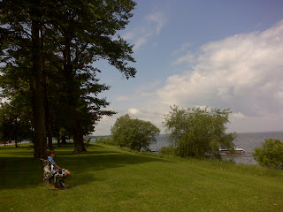
We stopped at a C-store in Lakeport to take a break and pick up a few things for lunch. We had planned to eat on the shore of Oneida Lake, and asked the clerk if we could get there by going down a side road across from the place. She told us that lakefront property was private, and the guy who owned it would chase us away as he was "evil". She directed us to a park a few miles further down Route 31, which was just great. Another confirmation that it pays to ask a local.
We are in Verona tonight, which is a little town northeast of Oneida. It is unremarkable except that there is a casino here, another one of those built by an Indian tribe. Casinos seem to have spread all over the country now and yet there seems to be no market saturation point, even in this stagnant economy. Gambling is not the sort of entertainment that we care for, but we don't have a problem with it either if it does not become obsessive. It would be interesting to learn what percentage of a typical casino's revenue comes from compulsive gamblers. I suspect it is high.
We met a couple from Canada today who asked a lot of questions about our trip but who acted like people made our type of trip frequently. They were in their mid-70s but were full of life and looked at least 10 years younger. He had several bikes and had just completed a 150 mile (two day) charity ride. Most amazingly, he was still playing on a rugby team! Are you kidding me? The discussion encouraged us to think we may be able to do this kind of thing longer than what we had assumed.
We stopped at a C-store in Lakeport to take a break and pick up a few things for lunch. We had planned to eat on the shore of Oneida Lake, and asked the clerk if we could get there by going down a side road across from the place. She told us that lakefront property was private, and the guy who owned it would chase us away as he was "evil". She directed us to a park a few miles further down Route 31, which was just great. Another confirmation that it pays to ask a local.
We are in Verona tonight, which is a little town northeast of Oneida. It is unremarkable except that there is a casino here, another one of those built by an Indian tribe. Casinos seem to have spread all over the country now and yet there seems to be no market saturation point, even in this stagnant economy. Gambling is not the sort of entertainment that we care for, but we don't have a problem with it either if it does not become obsessive. It would be interesting to learn what percentage of a typical casino's revenue comes from compulsive gamblers. I suspect it is high.
Greeeeeen Acres pic #2

Sent from my Verizon Wireless BlackBerry
Greeeeeen Acres pic #1

Sent from my Verizon Wireless BlackBerry


Subscribe to:
Posts (Atom)
.JPG)