Monday, September 7, 2009

Trip wrapup and reflections

First of all, thanks to the many of you who posted or emailed congratulations on the successful completion of our cross-country trip. We really appreciate all of the positive support, during and after the completion of our journey. Frankly, we were surprised how many people were following our adventures on a regular basis. We hope you enjoyed reading about the things that happened, our thoughts (both highs and lows, for sure) and the pictures of the places we visited and people we met.

I also want to apologize for not responding to many of the posts that were made during our trip. Due to a technical problem (i.e., I forgot my password), I could not respond to a post using my Blackberry. I was only able to respond to the writer directly if I happened to have that person's email address. So please don't think your comments were ignored. To the contrary, we read and cherished every one of them.

Now that we've been home for a few days it is a little easier to express some thoughts that have been rolling around inside our heads for the last couple of weeks:


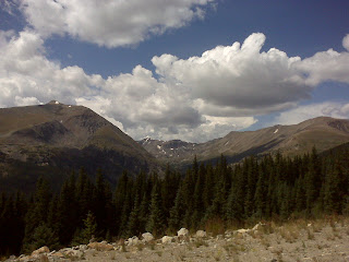
  • As much as we enjoy finally being back in our own home and seeing our family again, we already miss bike touring. It is a truly unique way to explore new places and meet new people. This is our second long, self-supported trip. A self-supported bike trip means far more contact with strangers than would be the case if we had a support vehicle ("sag wagon") follow along. We once again came away with the clear conviction that 99.9% of people are great, and that if you need to ask them for help you will get it. Maybe people don't feel threatened by touring cyclists, or identify with them emotionally for doing something a little out of the ordinary. In any event, we again experienced virtually universally positive 'good vibes' from the many people we met - in every area of the country that we traveled across.

  • Another thing we will miss is the occasional need to challenge ourselves to overcome obstacles and deal with unexpected circumstances (weather, bike maintenance issues, road construction, store and other support facility closings, etc.) You learn to be more self-reliant, flexible and creative in solving problems, since you simply have fewer of the normal alternative solutions available. While a steady stream of problems would certainly "get old," there can be a lot of satisfaction in figuring out a way around an obstacle.

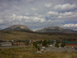
  • However, a long 'point to point' bike trip like this has its negative features. In addition to the negative of being away from home and family for months and months, the other big negative is that you are almost constantly moving. There were many times when we felt like we were "just passing through" a town because we just could not spend any more time there and still stay on schedule to return home by early September (our youngest daughter is expecting to deliver our 4th grandchild any day now). We almost certainly do some similar future trips, but they will probably be shorter in duration and more in the nature of "loop tours" (start and end in the same town) with a schedule that permits spending at least a couple of days in each place. In other words, less riding and more visting of cultural and historical sites as well as just 'hanging around' places that look interesting.

  • Nevertheless, it was a great trip and we feel very fortunate that we were able to do it (in terms of time, physical condition and financially). We encourage anyone out there who may be considering a similar trip to feel free to contact us for whatever assistance we may be able to provide. If you are such a person, our two main messages are:
  1. You can do it. You don't need to be an elite level athlete, or even close. General good health, realistic daily goals and a positive attitude are all that is required. Remember: the vast majority of people underestimate their ability to do something.
  2. Do it now. Don't it put off thinking that you'll be in better shape (physically, financially, etc.) in the future. Do it while you can - you cannot assume what the future will be like. We met countless people on our trip who told us "I've always wanted to do that." Yet is was pretty clear most of them never will because they will never take the first step and it will eventually turn into a lifetime regret.

Thanks again for all your support!

Steve and Penny

Tuesday, September 1, 2009

Woodland Park to Colorado Springs, CO (home)

Via Hwy 24 to Manitou Ave. exit, then secondary roads. 21.2 miles.

Our great adventure came to a happy and successful end today. After covering nearly 4,600 miles over roughly 3 and 1/2 months on the road, we completed our transcontinental tandem ride by returning to the home we left in April.*
We both feel like there isn't much that we cannot do, and that alone make it a great trip.

Our emotions are running the gamut: we are happy to have completed what we set out to do, and happy to be back in our own home after spending what seems like an eternity in motels and campgrounds - and generally eating poorly. At the same time, we will miss visiting new places and the challenge of overcoming physical limitations, adverse weather and other obstacles. Mostly though we will miss the people that we met almost daily along the way. From other cyclists who have inspired us to the many good people who have helped us out, invited us into their homes or just encouraged us.

In the next few days I will try to set out some things we learned from this experience, not only about bicycle touring but life. Thanks so much to all you blog readers - we hope that you have vicariously felt part of our trip and that you too will feel motivated to take up an additional challenge of some type.

*As previously explained, we took about a month off the bike beginning on June 22nd, the day after we reached our destination on Cape Cod which completed the eastern portion of our trip.
Sent from my Verizon Wireless BlackBerry

There's no place like home

We both lost a significant amount of weight, despite the greasy food, heavy beer drinking, etc. I wonder how long it will stay off?

Pikes Peak

North side view.
Sent from my Verizon Wireless BlackBerry

Monday, August 31, 2009

Fairplay to Woodland Park, CO

Via Hwys 9 (to Hartsel) and 24. 63.7 miles.

We climbed over our last 2 passes of the trip today, Wilkerson and Ute, and returned to the familiar territory of the Pikes Peak region. We made better time than we expected as we crossed the South Park area (high desert basin) and went over Wilkerson Pass on the Front Range of the Rocky Mountains. I had planned to take some pictures of the Collegiate Range from the top of Wilkerson (the Collegiates border South Park to the west), but the haze from the fires in southern California virtually obscured those peaks so I didn't bother.
We enjoyed a long descent from the top of Wilkerson to the town of Lake George (mile 46), where we had originally intended to stop for the day. Since it was only shortly after noon, we rode on - stopping for lunch a few miles down the road in Florissant. The weather had been great again up until we pulled out of Florissant and began the 8 mile climb to the top of Ute Pass at the town of Divide. As is typical in the afternoon along the Colorado Front Range, a bank of clouds began building to the west and the sky darkened significantly. Within a short time it began to spit rain on us. As usual, we were only concerned about possible lightening - not getting wet. This caused us to quicken our pace (i.e., "hump it") more than we could sustain. After about a mile of this overzealous effort, we pulled over to regroup and remind ourselves to stay calm and just ride at our normal pace. That got us back in the groove and we rode up and over the Ute Pass summit without hyperventilating (at least an excessive amount of the time). And, has so often happened on our trip, the storm really never materialized beyond a rumble or two of very distant thunder. We stopped in Woodland Park at our friend Rosi's house for the night. Tomorrow we have only a 25 mile ride (downhill for nearly the entire route) back to our house to complete our coast-to-coast journey.

This morning we met Walter, another east bound cyclist, who is a retired college professor (specializing in German literature). Walter appears to be in his late 60s or early 70s and is riding (solo) his THIRD transcontinental trip. He didn't seem to think it was any big deal, but did acknowledge that "this will probably be my last one." Penny later suggested that we do another coast-to-coast trip in 10 years to commemorate this one. I really hope we're physically able to do that but suspect we may be seeing the country from the inside of an RV at that point.
Sent from my Verizon Wireless BlackBerry

Gaggle of plastic wildlife

Pink flamingos adorn a yard in Florissant, CO.
Sent from my Verizon Wireless BlackBerry

Ascending Wilkerson Pass

Looking east about 4 miles from the summit.
Sent from my Verizon Wireless BlackBerry

South Park basin pic #3

Sent from my Verizon Wireless BlackBerry

South Park basin pic #2

South Park, like North Park, is a high desert basin surrounded by mountains.
Sent from my Verizon Wireless BlackBerry

South Park basin pic #1

Although not apparent in this picture, there was a lot of haze in the air today over the mountains, apparently smoke from the wildfires in California.
Sent from my Verizon Wireless BlackBerry

Sunday, August 30, 2009

Silverthorne to Fairplay, CO

Via the Summit County bike path and Hwy 9 39.5 miles.

It was kind of a watershed day today. On a cool but beautiful day we managed to get up and over Hoosier Pass, our last crossing of the Continental Divide and several thousand feet higher than any other pass we have surmounted. The first 22 miles from Silverthorne to about 4 miles below the top of the pass were a steady but manageable climb. The route rose 2,800 feet in elevation from Silverthorne to the top, and it seemed like 2,000 feet of it were contained in the last 4 miles. Those last few miles were probably the hardest we've encountered, partly because they were well above 10,000 feet, where the air begins to get thin (even for those of us who live at elevation). A couple of times I thought we were going to have to get off and push the tandem, but - despite coming close a couple of times - we did not stall out. We were rewarded for the hard climb by beautiful views from the top of the pass. We met a very nice woman on top who took numerous pictures of us in front of the sign

The weather forecast today wasn't great (50% chance of showers/thunderstorms) but the storms held off until we had ended the day's ride (once again). As we rolled into Fairplay the storm clouds followed closely behind us and we were thankful that we were no longer on the pass, where lightening strikes are more likely.

I was pretty sure this situation was going to happen at some point on this trip but I didn't think it would occur in the way it did. As we left Silverthorne we had to climb a very steep set of "switchbacks" on the bike path, as it wound its way up to the top of the dam at Lake Dillon (a reservoir created by the building of the dam on the Blue River). As we were struggling uphill, obviously in the anaerobic "red zone" (breathing at max), a guy and his buddy on sub-18 pound bikes pulled up along side us. He immediately attempted to chat us up about our trip, the brand of tandem we were riding (he had one too, made by a different frame builder) and the fact that he had seen us the day before yesterday riding along Green Mountain Reservoir. I could not even attempt to talk to him but Penny at least tried. But it should have been obvious to the guy (especially because he also rode a tandem) that we were in a state of major oxygen deprivation and could not spare two extra syllables. All I could think of was: can't you wait until we get to the top of the dam to have this conversation? But no, he was oblivious to our pulmonary distress. So I ignored him - I had no choice. The other day I had told Penny that I thought we would have this happen to us, but I assumed it would be a well-meaning but clueless tourist leaning out a car window as we staggered up a pass. Instead, it was a well-meaning but clueless cyclist who failed to appreciate: (a) the fact that we were on a tandem, which are notoriously heavy and slow going uphill (even though he also had a tandem); (b) our age; and (c) the load we were pulling. Clearly, some people are born without any common sense.

On a positive note, outside of Frisco, CO, we ran into a local guy who - despite also riding on a sub-18 pound bike - was very helpful in helping us negotiate the maze of bike path options between Silverthorne and Frisco. He was patient enough to wait for us in order to lead us through the most confusing set of turns (the pathways are numerous and not often well-marked) and allow us to find the main route to Breckenridge. So I have concluded that only 1/2 of the cyclists here are doofuses.

Sent from my Verizon Wireless BlackBerry

Rocky Mountain high

Summit of Hoosier Pass, at 11,539 feet it is the highest point we have reached on our entire journey.
Sent from my Verizon Wireless BlackBerry

Downtown Fairplay, CO

It's a happenin' place.
Sent from my Verizon Wireless BlackBerry

Hoosier Pass pic #3

Looking south toward Alma and Fairplay.
Sent from my Verizon Wireless BlackBerry

Hoosier Pass pic #2

Looking west.
Sent from my Verizon Wireless BlackBerry

Quandry Peak

From the top of Hazier Pass.
Sent from my Verizon Wireless BlackBerry

Penny takes a break

Near Frisco, CO.
Sent from my Verizon Wireless BlackBerry

Lake Dillon pic #4

Yeah, I know, this is probably overkill.
Sent from my Verizon Wireless BlackBerry

Lake Dillon pic #3

Sent from my Verizon Wireless BlackBerry

Lake Dillon pic #2

Sent from my Verizon Wireless BlackBerry

Lake Dillon

Summit County, CO.
Sent from my Verizon Wireless BlackBerry

Saturday, August 29, 2009

Rest day in Silverthorne, CO

Silverthorne is a collection of strip shops, motels and fast food places set down at the foot of the magnificent Gore Range in the middle of the popular Summit County, Colorado ski resorts (Breckenridge, Keystone, Copper Mountain, etc.) The highlight of our day (bear in mind that I HATE shopping) was going to the outlet mall here, which includes a Pearl Izumi store. For the non-cyclists reading this, Pearl Izumi makes high-end cycling wear, including shorts, jackets, etc.

Prior to today I had one pair of Pearl Izumi shorts, which are the most comfortable shorts I have ever had and have at least 2,500 miles on them. But this beloved pair of shorts developed a 'pilling' problem (the material bunched up) on the outside of the fabric in the crotch area. Thankfully this did not affect the comfort or life expectancy of the shorts, but it looked bad and - for what I paid for them - I felt they should be perfect despite the extensive use I have made of them. So today I took this pair into the outlet store and the clerk, a woman about my age who was obviously a serious cyclist, immediately said I would get full credit for the pair - no excuses, no receipt required, etc. She explained that she had experienced the same problem and that it was a combination of several things, none of which included a defective product.* I ended up getting two new pair (one "free" replacing the pilled pair and one I purchased) plus my third Zephyr model jacket.**

Why am I blogging about this? Because it illustrates the value of customer service and loyalty. I ended up spending more money at the Pearl Izumi store because they stand behind their products even if their is no problem with the product itself. Had the clerk attempted to make excuses or put the blame on me (where, honestly, it probably belonged) I would have stomped out of there and never again brought another pair of Pearl Izumi shorts. There are a few other merchants/manufacturers who follow the same philosophy*** and thus develop fanatical customer loyalty. Hello business leaders - take a hint.****

*The shorts were a size too big, the fabric was a very fine weave (why, ironically, cheaper shorts do not develop the same problem) and something on my saddle (probably the edge of the hole in the middle) was - over thousands of leg rotations - pulling on the fabric.

**The Zephyr jacket is a perfect weight for me about 80% of the time and is a great fit. I have worn the two previous jackets 'to death' but somehow managed to lose both of them. I lost the first one midway through our trip to Minnesota several years ago, and the second one on the first (eastern) leg of this trip.

***Two more personal examples:

(1) I have a Marmot 3 season jacket that developed a zipper problem after about 15 years of heavy use. I returned it to the local Marmot dealer (outdoor shop) which replaced the zipper free of charge. That was at least 5 years ago and I am still wearing the jacket. I don't own any other Marmot products but enthusiastically recommend them.

(2) I had a light tan canvas and leather Lands End suit carrier, monogrammed with my initials. It was given to me as a gift years ago. After being thrown into the back of countless taxicabs (usually up against the spare tire) the light tan canvas had become stained. Also one of the leather handles had become frayed. I happened to look at a Lands End catalog one day, and a little highlighted blurb in here stated (in so many words) 'if you are ever unsatisfied with any of our products at any time for any reason, return it for a replacement or refund'. So I boxed up and sent off my well-used luggage carrier and included a note stating that I'd like a dark blue one instead (to hide the dirt and grime better). A couple of weeks later I received a new, dark blue luggage carrier complete with the monogramming and a check in the amount of my postage cost. I have been a loyal customer ever since.

****Everyone probably has examples of the opposite philosophy too - make your products extremely difficult to use so that customers have to come back to you for help, and treat them in a condescending manner. Garmin (maker of GPS equipment and software) is at the top of my list.
Sent from my Verizon Wireless BlackBerry

Silverthorne, CO

A beautiful spot, if you can ignore the freeway, fast food places and shopping mall.
Sent from my Verizon Wireless BlackBerry

Friday, August 28, 2009

Hot Sulphur Springs to Silverthorne, CO

Via US 40 and Colo Hwy 9. 57.2 miles.

What should have been a great ride on a beautiful day turned out to pretty much suck. It was cold when we rolled out of Hot Sulphur Springs but the temperature had warmed up nicely by the time we arrived in Kremmling (mile 18). We followed US 40 along the Colorado River and enjoyed the gradual downhill ride on the wide shoulder of the highway.

After a stop at the grocery store in Kremmling to pick up some salami and cheese for lunch, we turned onto Colorado Hwy 9 toward Silverthorne. That's when things got ugly. The first 23-mile stretch of Hwy 9 from Kremmling toward Silverthorne is a hilly, winding, narrow, two-lane road along with no shoulder. It would be OK to ride with light traffic, but today it was packed with cars, RVs and BFTs. There simply wasn't enough room for all of the traffic to flow past us smoothly, resulting in periodically nerve-wracking situations where either: (1) traffic going our direction (southbound) was passing us at the same time that oncoming traffic was passing: or (2) someone in the oncoming lane was passing another vehicle as that vehicle was going past us. In both cases, for at least an instant, there were two vehicles and us abreast across the road. It was very unpleasant and pretty much spoiled the ride for both of us. Even after we reached the safety of a wide shoulder (about 15 miles from Silverthorne) our mood didn't improve. As the song goes, some days (such as yesterday) are diamonds and some days (e.g., today) are rust.

We did meet 2 other cyclists today, which was interesting. The first guy is riding from Lake Tahoe to Maine. He said he is averaging over 100 miles a day and plans to arrive in late September. Yeow! The other guy is riding the Great Divide mountain bike route from the Canadian border to the Mexican border. He also said that he was in a hurry because he had a job to get back to,* but we noted that he was one of the few riders we have come across who was slower than us.

We are going to take a rest day here tomorrow (shopping at the outlet mall, what fun). Then we'll have only 3 more riding days left to complete our cross-country trip. It seems surreal in many ways - we have been on the road so long it is going to be a little weird to be back at home with no plans to get on the bike again in the near future. I will miss the adventure, the new sights and the interesting people you tend to meet on a trip of this nature. But we are both tired of traveling and ready to be done.

*He said worked for the Department of Homeland Security and had a solar-powered satellite tracking device with him so DSS could keep track of him. This sounds goofy, but Devon (the solo woman rider we met in Oregon) also carried one of these things (her mom brought for her).
Sent from my Verizon Wireless BlackBerry

Penny in shadow

Sent from my Verizon Wireless BlackBerry

Rare picture of the two of us together

Usually there is no one else around to take pictures.
Sent from my Verizon Wireless BlackBerry

Another cyclist we met today pic #2

Note the "helmet" and "cycling jersey".
Sent from my Verizon Wireless BlackBerry

Another cyclist we met today

This guy is on his way from the Canadian border to the Mexican border. He was riding the ACA's Great Divide route (mountain bike route that uses dirt roads and trails), but decided to ride on Hwy 9 for awhile to speed his progress (he has to get back to a job with the Department of Homeland Security).
Sent from my Verizon Wireless BlackBerry

The Gore Range, pic #3

Sent from my Verizon Wireless BlackBerry

The Gore Range, pic #2

Sent from my Verizon Wireless BlackBerry

The Gore Range, pic #1

South of Kremmling, CO. Note old mine in the foreground.
Sent from my Verizon Wireless BlackBerry

The Gore Range, pic #1

South of Kremmling, CO. Note old mine in the foreground.
Sent from my Verizon Wireless BlackBerry

Thursday, August 27, 2009

Walden to Hot Sulphur Springs, CO

Via Hwy 125 and US 40. 62 miles.

Days like today are why we like living in Colorado and riding bicycles here. We enjoyed a scenic ride on quiet roads on a classic Colorado early Fall day.
That is, bright blue skies, with cool temperatures in the morning warming to the mid-70s in the afternoon.

We left Walden and immediately began the gradual 32-mile ascent out of the North Park basin over Willow Creek Pass. Part of the basin is a wildlife preserve where we saw a herd of antelope, an eagle, a badger and lots of geese. We also saw a hunter and his young son carrying an antelope carcass across the tundra toward their truck (we did not stop to ask if it was a legal kill). It looked like they were working a lot harder than we were.

The pass turned out to be one of the gentler ones we have crossed and we enjoyed a long descent down the east side. The road ran along Willow Creek, where there were quite a few campers and fishermen. The tall pine trees, as in most other areas of the state, had been decimated by the pine beetle infestation. There were miles and miles of dead and dying trees that took many years to mature. Apparently the Forest Service has no plans to remove the dead trees, so eventually they will probably topple over and then maybe some new growth can occur.
It's sad to see, but nature's way I guess.

We saw a couple of other touring cyclists headed up the east side of the pass as we came down, the first we've seen in several days. It seems clear that the vast majority of riders have completed their east-to-west journey, which makes sense as most of them are of college age and have to get back for school. On the plus side, there aren't too many people on the road. We've had no problem finding places to stay, restaurants are less than half filled, etc. The summer tourist season is pretty much over, big game hunting season hasn't started and it's way too early for skiing.
Sent from my Verizon Wireless BlackBerry

Hot Sulphur Springs, CO

A really nice little town with nice people. And a natural hot springs!
Sent from my Verizon Wireless BlackBerry

Scenery from today's ride pic #1

Looking southeast on Hwy 125 a few miles north of the junction with US 40.
Sent from my Verizon Wireless BlackBerry

Scenery from today's ride pic #2

Looking northwest on Hwy 125 on the south side of Willow Creek Pass.
Sent from my Verizon Wireless BlackBerry

Roadside lunch stop along Willow Creek

Notwithstanding the dead trees, Colorado still a very pretty place.
Sent from my Verizon Wireless BlackBerry

Beetle kill

The pine beetle has destroyed millions of trees, many of which took almost a century to reach their current height.
Sent from my Verizon Wireless BlackBerry

Radial Mountain?

I think this is a picture of Radial Mountain, one of the significant peaks on the south side of Willow Creek Pass.

Willow Creek Pass

Sent from my Verizon Wireless BlackBerry

North Park pic #2

Northwest of Rand, CO.
Sent from my Verizon Wireless BlackBerry

North Park wildlife

They're hard to see 'cause the damn things ran away from us and wouldn't sit still for a picture, but those white animals are a herd of 4 antelope.
Sent from my Verizon Wireless BlackBerry

Sign

In cafe window in Walden, CO. For you non-westerners, these oysters do not qualify as seafood.
Sent from my Verizon Wireless BlackBerry

Wednesday, August 26, 2009

Riverside, WY to Walden, CO

Via Hwys 230/125. 49.6 miles.

It was a beautiful ride today, although quite tough, as we crossed back into our home state of Colorado after having left on this trip on April 24th. The first 19 miles, in particular, was difficult as the road (Hwy 230, in Wyoming, which became Hwy 125 in Colorado) rose up and down (but trending upward overall). We agree with most cyclists that such up and down terrain is more tiring than simply going up to the top of a long pass, then down (the profile of tomorrow's ride).

Once again, the clouds threatened rain off and on all day. When we were about 5 miles from reaching the Colorado border, a thunderstorm broke out in the mountains to the west. We could hear the thunder and see lightening hitting the tops of the peaks. That sent our adrenaline into overdrive. There was no storm shelter of any kind within view (not even a ditch), and I am deathly afraid of lightening,* so we humped it to try to skirt the edge of the storm cloud. Although the road went uphill (of course), I am happy to report that we succeeded, mainly because the storm never really moved off the mountain tops.

We stopped to eat some lunch (peanut butter on bagels, apples and cookies) in Cowdrey (population 77), another near ghost town (the only open business
was the post office). There we met a woman from California who was considering buying a run-down building there. She seemed well-meaning, but what could she be thinking? There were some newly-reopened cabins there for fishermen and other seasonal visitors and a post office, but nothing else. Good luck.

The last time we were in Walden was about 20 years ago. We were then on another bike ride, one of the annual Pharo Death Rides that we have been doing with a group of friends since about 1981. My recollection of Walden from that time was that it was a dump (like Jeffrey City, WY). The motel we stayed in on that trip (now thankfully gone) was a seedy place that smelled of natural gas. We took a group photo on that trip, in front of the Walden cemetery gates. It was foggy that morning and the fog gave the picture an eerie quality that made it a memorable shot.
Walden, which is the county seat of Jackson County, CO, looks a lot better now than what I remember from that earlier trip. The main street through town has several active businesses and the buildings are in good shape. There seem to be more local people here now. But the cemetery hasn't changed much, as one would expect. We hope to get a picture in front of the gates tomorrow.

*This fear is not unfounded. Colorado has the highest death rate in the nation from lightening strikes.
Sent from my Verizon Wireless BlackBerry

Scenery from today's ride pic #3

Sent from my Verizon Wireless BlackBerry

Scenery from today's ride pic #3

Another scene on Hwy 230 north of the Colo-WY border.
Sent from my Verizon Wireless BlackBerry

Scenery from today's ride pic #2

Ranch north of the Colorado-Wyoming border.
Sent from my Verizon Wireless BlackBerry

Cattle drive

On Hwy 230 about 10 miles north of the Colorado border. Honest-to-God cowboys (not Billy Crystal) were leading a herd of cows along the side of the road.
Sent from my Verizon Wireless BlackBerry

Scenery from today's ride

Looking west on Hwy 230 near the Wyoming-Colorado border.
Sent from my Verizon Wireless BlackBerry

Back in the Centennial State at last

We were more concerned about a nearby thunderstorm than getting a good picture, but this still turned out pretty well.
Sent from my Verizon Wireless BlackBerry

North Park pic #3

This is a very deceptive picture in that it was probably the only flat stretch on today's nearly 50 mile ride.
Sent from my Verizon Wireless BlackBerry

North Park pic #2

The historic marker tells of the silver and coal mining history of the area.
Sent from my Verizon Wireless BlackBerry

North Park pic #1

North Park is not a real "park" (or even a shopping mall), but is an elevated basin in northern Colorado ringed by mountains.
Sent from my Verizon Wireless BlackBerry

Walden, CO

No, Thoreau did not come here to stare at a pond. This is fishing and hunting country, writing poetry is illegal.
Sent from my Verizon Wireless BlackBerry

Sinclair, WY pic #1

OK, the refinery isn't very scenic but it's about the most interesting thing we saw today.
Sent from my Verizon Wireless BlackBerry

Sinclair, WY pic #2

This is a better picture of the refinery. I can't imagine living here - it smells really bad. But among the locals the refinery stench is called "the smell of money."
Sent from my Verizon Wireless BlackBerry

Overland Trail historic marker

Between Walcott and Saratoga, WY. You can see the wagon ruts of the trail to the left and behind the marker.
Sent from my Verizon Wireless BlackBerry

Storm clouds over Wyoming

Between Saratoga and Riverside, WY. Fortunately we only received a few drips of rain and a pretty stiff head wind out of this.
Sent from my Verizon Wireless BlackBerry