Monday, September 7, 2009

Trip wrapup and reflections

First of all, thanks to the many of you who posted or emailed congratulations on the successful completion of our cross-country trip. We really appreciate all of the positive support, during and after the completion of our journey. Frankly, we were surprised how many people were following our adventures on a regular basis. We hope you enjoyed reading about the things that happened, our thoughts (both highs and lows, for sure) and the pictures of the places we visited and people we met.

I also want to apologize for not responding to many of the posts that were made during our trip. Due to a technical problem (i.e., I forgot my password), I could not respond to a post using my Blackberry. I was only able to respond to the writer directly if I happened to have that person's email address. So please don't think your comments were ignored. To the contrary, we read and cherished every one of them.

Now that we've been home for a few days it is a little easier to express some thoughts that have been rolling around inside our heads for the last couple of weeks:


  • As much as we enjoy finally being back in our own home and seeing our family again, we already miss bike touring. It is a truly unique way to explore new places and meet new people. This is our second long, self-supported trip. A self-supported bike trip means far more contact with strangers than would be the case if we had a support vehicle ("sag wagon") follow along. We once again came away with the clear conviction that 99.9% of people are great, and that if you need to ask them for help you will get it. Maybe people don't feel threatened by touring cyclists, or identify with them emotionally for doing something a little out of the ordinary. In any event, we again experienced virtually universally positive 'good vibes' from the many people we met - in every area of the country that we traveled across.

  • Another thing we will miss is the occasional need to challenge ourselves to overcome obstacles and deal with unexpected circumstances (weather, bike maintenance issues, road construction, store and other support facility closings, etc.) You learn to be more self-reliant, flexible and creative in solving problems, since you simply have fewer of the normal alternative solutions available. While a steady stream of problems would certainly "get old," there can be a lot of satisfaction in figuring out a way around an obstacle.

  • However, a long 'point to point' bike trip like this has its negative features. In addition to the negative of being away from home and family for months and months, the other big negative is that you are almost constantly moving. There were many times when we felt like we were "just passing through" a town because we just could not spend any more time there and still stay on schedule to return home by early September (our youngest daughter is expecting to deliver our 4th grandchild any day now). We almost certainly do some similar future trips, but they will probably be shorter in duration and more in the nature of "loop tours" (start and end in the same town) with a schedule that permits spending at least a couple of days in each place. In other words, less riding and more visting of cultural and historical sites as well as just 'hanging around' places that look interesting.

  • Nevertheless, it was a great trip and we feel very fortunate that we were able to do it (in terms of time, physical condition and financially). We encourage anyone out there who may be considering a similar trip to feel free to contact us for whatever assistance we may be able to provide. If you are such a person, our two main messages are:
  1. You can do it. You don't need to be an elite level athlete, or even close. General good health, realistic daily goals and a positive attitude are all that is required. Remember: the vast majority of people underestimate their ability to do something.
  2. Do it now. Don't it put off thinking that you'll be in better shape (physically, financially, etc.) in the future. Do it while you can - you cannot assume what the future will be like. We met countless people on our trip who told us "I've always wanted to do that." Yet is was pretty clear most of them never will because they will never take the first step and it will eventually turn into a lifetime regret.

Thanks again for all your support!

Steve and Penny

Tuesday, September 1, 2009

Woodland Park to Colorado Springs, CO (home)

Via Hwy 24 to Manitou Ave. exit, then secondary roads. 21.2 miles.

Our great adventure came to a happy and successful end today. After covering nearly 4,600 miles over roughly 3 and 1/2 months on the road, we completed our transcontinental tandem ride by returning to the home we left in April.*
We both feel like there isn't much that we cannot do, and that alone make it a great trip.

Our emotions are running the gamut: we are happy to have completed what we set out to do, and happy to be back in our own home after spending what seems like an eternity in motels and campgrounds - and generally eating poorly. At the same time, we will miss visiting new places and the challenge of overcoming physical limitations, adverse weather and other obstacles. Mostly though we will miss the people that we met almost daily along the way. From other cyclists who have inspired us to the many good people who have helped us out, invited us into their homes or just encouraged us.

In the next few days I will try to set out some things we learned from this experience, not only about bicycle touring but life. Thanks so much to all you blog readers - we hope that you have vicariously felt part of our trip and that you too will feel motivated to take up an additional challenge of some type.

*As previously explained, we took about a month off the bike beginning on June 22nd, the day after we reached our destination on Cape Cod which completed the eastern portion of our trip.
Sent from my Verizon Wireless BlackBerry

There's no place like home

We both lost a significant amount of weight, despite the greasy food, heavy beer drinking, etc. I wonder how long it will stay off?

Pikes Peak

North side view.
Sent from my Verizon Wireless BlackBerry

Monday, August 31, 2009

Fairplay to Woodland Park, CO

Via Hwys 9 (to Hartsel) and 24. 63.7 miles.

We climbed over our last 2 passes of the trip today, Wilkerson and Ute, and returned to the familiar territory of the Pikes Peak region. We made better time than we expected as we crossed the South Park area (high desert basin) and went over Wilkerson Pass on the Front Range of the Rocky Mountains. I had planned to take some pictures of the Collegiate Range from the top of Wilkerson (the Collegiates border South Park to the west), but the haze from the fires in southern California virtually obscured those peaks so I didn't bother.
We enjoyed a long descent from the top of Wilkerson to the town of Lake George (mile 46), where we had originally intended to stop for the day. Since it was only shortly after noon, we rode on - stopping for lunch a few miles down the road in Florissant. The weather had been great again up until we pulled out of Florissant and began the 8 mile climb to the top of Ute Pass at the town of Divide. As is typical in the afternoon along the Colorado Front Range, a bank of clouds began building to the west and the sky darkened significantly. Within a short time it began to spit rain on us. As usual, we were only concerned about possible lightening - not getting wet. This caused us to quicken our pace (i.e., "hump it") more than we could sustain. After about a mile of this overzealous effort, we pulled over to regroup and remind ourselves to stay calm and just ride at our normal pace. That got us back in the groove and we rode up and over the Ute Pass summit without hyperventilating (at least an excessive amount of the time). And, has so often happened on our trip, the storm really never materialized beyond a rumble or two of very distant thunder. We stopped in Woodland Park at our friend Rosi's house for the night. Tomorrow we have only a 25 mile ride (downhill for nearly the entire route) back to our house to complete our coast-to-coast journey.

This morning we met Walter, another east bound cyclist, who is a retired college professor (specializing in German literature). Walter appears to be in his late 60s or early 70s and is riding (solo) his THIRD transcontinental trip. He didn't seem to think it was any big deal, but did acknowledge that "this will probably be my last one." Penny later suggested that we do another coast-to-coast trip in 10 years to commemorate this one. I really hope we're physically able to do that but suspect we may be seeing the country from the inside of an RV at that point.
Sent from my Verizon Wireless BlackBerry

Gaggle of plastic wildlife

Pink flamingos adorn a yard in Florissant, CO.
Sent from my Verizon Wireless BlackBerry

Ascending Wilkerson Pass

Looking east about 4 miles from the summit.
Sent from my Verizon Wireless BlackBerry

South Park basin pic #3

Sent from my Verizon Wireless BlackBerry

South Park basin pic #2

South Park, like North Park, is a high desert basin surrounded by mountains.
Sent from my Verizon Wireless BlackBerry

South Park basin pic #1

Although not apparent in this picture, there was a lot of haze in the air today over the mountains, apparently smoke from the wildfires in California.
Sent from my Verizon Wireless BlackBerry

Sunday, August 30, 2009

Silverthorne to Fairplay, CO

Via the Summit County bike path and Hwy 9 39.5 miles.

It was kind of a watershed day today. On a cool but beautiful day we managed to get up and over Hoosier Pass, our last crossing of the Continental Divide and several thousand feet higher than any other pass we have surmounted. The first 22 miles from Silverthorne to about 4 miles below the top of the pass were a steady but manageable climb. The route rose 2,800 feet in elevation from Silverthorne to the top, and it seemed like 2,000 feet of it were contained in the last 4 miles. Those last few miles were probably the hardest we've encountered, partly because they were well above 10,000 feet, where the air begins to get thin (even for those of us who live at elevation). A couple of times I thought we were going to have to get off and push the tandem, but - despite coming close a couple of times - we did not stall out. We were rewarded for the hard climb by beautiful views from the top of the pass. We met a very nice woman on top who took numerous pictures of us in front of the sign

The weather forecast today wasn't great (50% chance of showers/thunderstorms) but the storms held off until we had ended the day's ride (once again). As we rolled into Fairplay the storm clouds followed closely behind us and we were thankful that we were no longer on the pass, where lightening strikes are more likely.

I was pretty sure this situation was going to happen at some point on this trip but I didn't think it would occur in the way it did. As we left Silverthorne we had to climb a very steep set of "switchbacks" on the bike path, as it wound its way up to the top of the dam at Lake Dillon (a reservoir created by the building of the dam on the Blue River). As we were struggling uphill, obviously in the anaerobic "red zone" (breathing at max), a guy and his buddy on sub-18 pound bikes pulled up along side us. He immediately attempted to chat us up about our trip, the brand of tandem we were riding (he had one too, made by a different frame builder) and the fact that he had seen us the day before yesterday riding along Green Mountain Reservoir. I could not even attempt to talk to him but Penny at least tried. But it should have been obvious to the guy (especially because he also rode a tandem) that we were in a state of major oxygen deprivation and could not spare two extra syllables. All I could think of was: can't you wait until we get to the top of the dam to have this conversation? But no, he was oblivious to our pulmonary distress. So I ignored him - I had no choice. The other day I had told Penny that I thought we would have this happen to us, but I assumed it would be a well-meaning but clueless tourist leaning out a car window as we staggered up a pass. Instead, it was a well-meaning but clueless cyclist who failed to appreciate: (a) the fact that we were on a tandem, which are notoriously heavy and slow going uphill (even though he also had a tandem); (b) our age; and (c) the load we were pulling. Clearly, some people are born without any common sense.

On a positive note, outside of Frisco, CO, we ran into a local guy who - despite also riding on a sub-18 pound bike - was very helpful in helping us negotiate the maze of bike path options between Silverthorne and Frisco. He was patient enough to wait for us in order to lead us through the most confusing set of turns (the pathways are numerous and not often well-marked) and allow us to find the main route to Breckenridge. So I have concluded that only 1/2 of the cyclists here are doofuses.

Sent from my Verizon Wireless BlackBerry

Rocky Mountain high

Summit of Hoosier Pass, at 11,539 feet it is the highest point we have reached on our entire journey.
Sent from my Verizon Wireless BlackBerry

Downtown Fairplay, CO

It's a happenin' place.
Sent from my Verizon Wireless BlackBerry

Hoosier Pass pic #3

Looking south toward Alma and Fairplay.
Sent from my Verizon Wireless BlackBerry

Hoosier Pass pic #2

Looking west.
Sent from my Verizon Wireless BlackBerry

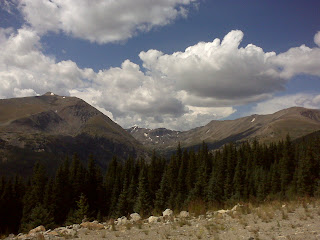
Quandry Peak

From the top of Hazier Pass.
Sent from my Verizon Wireless BlackBerry

Penny takes a break

Near Frisco, CO.
Sent from my Verizon Wireless BlackBerry

Lake Dillon pic #4

Yeah, I know, this is probably overkill.
Sent from my Verizon Wireless BlackBerry

Lake Dillon pic #3

Sent from my Verizon Wireless BlackBerry

Lake Dillon pic #2

Sent from my Verizon Wireless BlackBerry